Mars & Yum! Brands Get Closer to Customers With Spatial Analytics

More companies are turning away from traditional market research datasets, looking toward more specialized alternatives that provide deeper, localized benefits. Yum Brands and Mars, for example, are leveraging spatial analytics to lead a massive international expansion and zone in on behavior and location insights to plan their growth strategies.
In this edited transcript of CGT’s latest webinar, CARTO’s Matt Forrest joins CGT's Lisa Johnston to dig into two recent case studies. Read on to learn by example from Mars and Yum.


Lisa Johnston: Hello everyone. Welcome to “How Companies Like Mars & Yum! Use Spatial Analytics for POS Analysis & Customer Segmentation.” My name is Lisa Johnston, editor-in-chief of CGT.
The way consumers live and move throughout the world are changing, thanks to shifting behavior habits and the rise of hybrid work. Now, what this has meant for both CPGs and retailers is that they need to reassess how their point-of-sale footprints are holding up for the new expectations.
Here at CGT and RIS, we know that more companies are turning away from traditional market research data sets to alternative data sets in order to get a more accurate and holistic view of consumer insights. This includes brands that want to better understand how location impacts category performance. Today, we are joined by Matt Forrest of CARTO to talk about why CPGs and retailers are using spatial analysis to understand target segments.
Matt is VP of solutions engineering at CARTO, a company that focuses on creating tools that solve geospatial problems. Using advanced spatial data science techniques, Matt works to find solutions to business questions by understanding the role that space and place have on companies across many industries.
To get started, there are probably people here that are very familiar with spatial analytics, but also some who have heard of it but aren't as aware of the benefits. Matt, how would you best explain spatial analytics to someone who's completely new to the subject?
Matt Forrest: When you think about anything that happens in physical space, that's generally how you would think about geospatial or spatial analytics. It can go by many names, including GIS, spatial analytics, location intelligence, or spatial data science. A good example is something that's pretty simple in concept but very complex to measure, study, and understand. It's a concept of trade areas.
If you have a retail location or a point-of-sale, you want to understand where the patrons of that location are coming from. What you want to do is establish a trade error. This could be done traditionally with a few different methods, such as drawing a simple radius around that and noting that everyone within a mile will likely come to this location.
There's an older model called the Gravity Model, which relied on surveys and things of that sort, defining different locations with weights, competitors, etc. More recently, we've been using things called Drive-Time Rings — or Isochrones is the technical term. This identifies the area that could be reached within a 5-, 10-, 8-, 15-minute drive of that location. Of course, that doesn't capture every single person that goes to that location, but fortunately, we've been able to enhance that with new spatial data called human mobility data.
This is data that's collected from a mobile device or cell phone that shows a location and is then anonymized and aggregated. It allows you to find the most common areas that people who come to this location or have seen in that location come from.
It also provides good data to tie back to, including things as simple as demographics, age, gender, media, and income; or more advanced consumer segments that can be created from that demographic data. There's a lot of other data that can be added into that, but it's the combination of those data sets that's the first step in the analysis. That can tell you where things are happening, but ultimately understand why. It's a combination of that data plus different spatial analysis techniques that you can use.
We'll talk about some of those today, but the one I’d like to talk about is white space. We’ll break that one apart and why it’s important, but also using more advanced techniques such as machine learning and predictions to understand where you should go next and what areas to avoid.
Johnston: Matt, can we talk about why the retailers in the CPGs that you work with are using these types of analytics?
Forrest: We work with a combination of both retailers and CPG companies. I'll go between the two to speak to the complete audience, and then if there's any specific questions we can dive into those.
The first is understanding point-of-sale exploration. That's that first step to understanding where locations are. In the CPG context, you can start to understand a place or location where you’re selling a product by understanding who's coming to that location: Who are the likely customers? That tells you a very specific story about the store’s make up and groupings of individuals. It might be a younger population with more money to spend, or it could be a more family-oriented market that's budget conscious.
We’re able to start to break these out into groupings of not just consumers but stores, which can inform the route-to-market strategy of what products to place in what locations. Maybe you want to understand marketing dollar spend or budget in-store, how to appropriately allocate that and where. That can inform everything from sales team strategy and roll out from that perspective so it gets very specific. It's really profiling your stores and end customers, not necessarily the consumer itself. Of course, where the consumer lives is important, but where they buy is different based on where they might live, work, or the places they're going to when they come home.
Mobility data provides a great perspective into that. Of course, you can also look into if someone's on the path home, how you could possibly influence advertising or things like that. If there's a large group commuting between a suburb of Dallas and the downtown area, you want to understand their likely paths back to that location. These highways are very important to inform advertising spend, etc. If you are able to do different targeting, for example a reminder about that or advertising is a good use case for this, too. All that data can inform decisions, not just where to place products but marketing, sales, and so forth.
From the retail perspective, it’s incredibly important to understand who's going into which locations, what competitors are nearby, and how that’s influencing analysis around cannibalization. All of that is tied to location and the mobility data can be very granular. We've also worked with companies that do this in the new real retail context, where they're doing a lot of shipping and online ordering. This allows them to easily see if they have someone that's shopping in the store and can connect that to online data.
That's really important. The last influential piece is whether you can tie a specific product purchase to a location at a date and time to understand where that person comes from. It will enable a rich picture of what products are being sold to who, then tying that back to one skin, the demographics, and all these different components. That point-of-sale or store location is a fundamental part of all this. It gives a perspective of where you can easily filter and see what's going on, categorize locations and make decisions from that. That's the first step in the process.
Johnston: When you talk about the different types of data that retailers and CPGs have when they come to you, how do you work with companies to use the data that they have, or get the data that they want?
Forrest: It's certainly in the best-case scenario for a retailer to have that data you just described. There was a purchase at this location for many dollars of this product — over time, you can understand a granular picture of what customers want and figure out where those customers are. That gives an interesting data perspective to play with.
From a CPG side, a lot of that comes from distributors. Unless you're self-distributing or doing some direct-to-consumer, which is a major trend right now, distributors will have some data at different levels — maybe at the point-of-sale level, an aggregated view like zip code or county, it varies. Sometimes, you can tell from a metro area or territory coverage what's happening. Even at those higher levels, you can break it down and understand what's going on from a product perspective.
Trying to break that down to the granular level is always going to be the best case — even at a territory or metro level, we can get that data about consumers, stores, etc. to understand the broad demographics of these 10 metro areas, why these product sales are picking up in those areas, which stores those might be happening in, and make more informed, targeted choices from that.
Of course, on the CPG side, a lot of this is reliant on the sales team and discussing with the individual points of sale. That's an important part of this entire process — one I don't want to dismiss — because that's critical. Some of these assumptions can ground truth and help you see what’s happening where, maybe you’re seeing something different and compare it. You never want to pull the human aspect out of this because it adds and informs.
If you're trying to break into a new market, this can give you a base to start from to know which products are sold in which location. Then, you can tie that to the individuals and everything from there. Regardless of what you have from a data perspective, you can always start with who's coming to which locations and the supportive data around that. You can create those trade areas from human mobility data, see the visits, start to estimate the size of the store or those different factors, and then all the consumer segmentation, even social conversation data sets to road traffic, all play into this as well.
Johnston: I'm glad you brought out the human aspect. Let’s dive into a couple case studies. We're going to talk about how your team worked with Yum! Brands and Mars. Starting with Yum! Brands, can you set up the story: why did they approach you or what were the pain points they were experiencing?
Forrest: It was pretty unique. We've worked with them in a few different contexts, one being international expansion. A lot of people know the playbook in certain countries and certain countries have better data to begin with than others, but they know the playbook in the U.S. Once you start to translate that to new markets, how do you do a store point-of-selection or QSR location strategy for Thailand or other markets? That's where we wanted to work from. It was a blank slate in a way. They had some assumptions, had stores operating, but needed more data to inform what's next. After starting with these locations, we've worked with teams on the ground to figure it out.
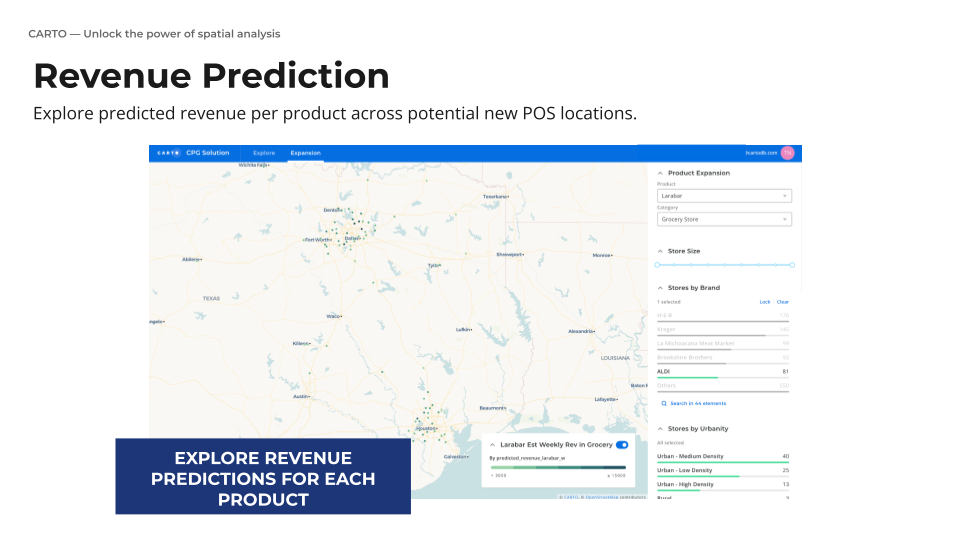
The next layer goes deeper for rolling out a new brand. Starting from a perspective of where and what data can be brought in, we can then predict revenue for new locations — which ones are going to be more profitable or better to invest in. That brings up the aspect of international data and comparable data sets (apple to apples) between markets, which we've worked on quite a bit because customers that are successful in the U.S. want to move into another country.
We’ve built a data observatory that allows access and acquisition of different data sets in different countries. This provides a global demographic data set, including human mobility data and different providers in different areas and regions, that can be brought in for different countries.
It’s become a data marketplace as a beginning step to allow for an easier path to get a handle on geospatial data. The problem in the market now is that there's a lot of vendors to choose from, which means a lot of evaluation of data, a lot of paperwork and sales processes, etc. We try to make that easier by saying “it's here and ready for you to use, take a look, and then go from there.” Once you begin to hit these different countries, you can start to build that out — even if it's not data you need to buy or purchase. There are open data sets that are valuable to help paint an initial picture. There's great global point-of-interest data sets from a tool called Open Street Map.
There's very basic global demographics that we provide to offer estimates of population and age. We can interpolate that with satellite imagery to understand where pockets of development and built environment are. It gives a starting point to understand what's there, even if you know nothing — an initial base to start from. That’s what YumStar needed, a global data strategy, where to go, what data to acquire, and what that looked like. Demographics were the first step within that. Next we layered human mobility so that the data engineering team could bring that data into their environment to work into existing models. From there, they were able to identify if they roll out this type of store in this location, based on what we know about a comparable market or similar location, we would expect X-amount of revenue. They can compare that to what they already have in the nation and go from there. That international case was the first one.
The second one was with one of their brands, trying to target white space. Effectively, they had expanded that restaurant's footprint so much that they were trying to figure out, in terms of revenue, whether there's more profitable locations. They also rolled out a new store model which breaks the original assumptions of what they wanted to do. In many QSR or fast food cases, it's reasonable to say that with a good commercial center, enough car traffic, and enough location to other locations or a strip mall, etc., they would likely perform well. That's the dominating model for a long time.
Once you reach a certain inflection point more data is needed, or if you're going to a new model as in this case, it was more of a storefront in cities that was more accessible — you can't take the same assumptions of car traffic, etc. data into that. We used a white space model to understand, given the open areas they weren’t operating in, can we simulate predictions of new locations across all those places to identify where the best ones are so that it doesn’t overlap with the existing footprint. You can control the range of that location and understand who might be operating in that region.
If there's franchisee rules or something of that manner, those are important to understand, then scope that to know what is a good location, who might have the rights to it, and go from there, as well as understand the demographic footprint and predicted revenue. It’s a very granular view of what would happen if we go to this location. It encompasses a lot of new data. It's essentially the walkability, including detail around left turns or proximity to highway interchanges that can be layered that may have not have been considered before to pull out what those factors are.
For that new footprint, there were a few things that stand out, including proximity to a large population that wants that food, whether that's college campuses, a downtown area, or late night locations. That's what human mobility data offers: who's coming to locations with similar populations and expanding from that perspective. There are different cases that include different brands and locations, both in the U.S. and abroad.
Johnston: It sounds like you're not only able to get much more granular, but also leverage insights when there's no historical data available. Would you say that's fair?
Forrest: Absolutely. With the new store model there was limited data. They had some similar models, but it was much farther away from the traditional set of locations. Basically, they have assumptions about what these will look like and can test those in theory to see these are these populations and as they roll them out, the data and models or machine learning will increase to actually drive this and what to look for in the future. As that hones in, you'll have the same for these locations — demographics, model mobility or trade areas, add in car traffic, then other features that spatial analysts may or may not know, but the restaurant owners or other teams will know.
If there's a divided road, it's a pain to make a left turn, that's a problem in terms of a location selection issue. That's something that may decrease revenue, accessibility — it's easier to make a right turn into a location or a corner location. Those are key things that you want to factor in, even things like signage, visibility, and more are up for play. It’s a matter of using that data that exists out in the world already to start informing your strategy.
Johnston: It makes perfect sense from a user perspective. There's at least one quick service restaurant in my town that I won't go to because I can't make a left turn out of there. It's off limits. We can probably all relate. What can you tell us, when it comes to Yum!, about the integration process and how it helped them achieve their initial goals?
Forrest: It worked nicely because they had it in existing data infrastructure. Naturally, we plug into a lot of different data infrastructures, commonly data warehouses and databases work within CARTO's environment. We don't maintain our own database. We have one that customers can use if they don't have an existing data infrastructure, but if they do, it sits there and we put our platform on top of it. Similar to a Tableau where it plugs into the existing data infrastructure, and the data warehouses and databases have these geospatial capabilities in them.
We use what's already there. It's not big on maintenance or the installation perspective. Once it's there, we have two tools that allow us to run those models directly into those data warehouses for questions of site selection and white space cannibalization.
We use the existing data and then the spatial data from the data observatory sits alongside that to do the combinations of joining that data, creating those trade areas, so on and so forth. For retail customers, there's a specific package that does that so you can do that on your own and use our models that we built. There's an application layer that sits on top of that that does this in a UI model. The site selection application gives you a very detailed view of pointing and clicking, doing revenue models, white space, and you can run as many as you want to build that over time.
We try to make that easy to use and are working on a similar process for the CPG space as well. The integration that is one of the bigger headaches is where to put this data: Do I have to connect? How does that move about? How do I do the enrichment process? That's the painful part, and if you can't do that, you're stuck.
We integrated nicely and then a lot of it was hearing what people are doing today. Everyone knows a lot of the problems — as I mentioned, the human factor — and the more you can understand what's going on, listen to individual franchisees, restaurant owners, distributors, or sales force in the field, they're going to have a lot of great information that can start to queue in to identify important factors and capture that from a geospatial perspective. There's all these factors we can study, analyze, and bring in that lay a good foundation for that.
Johnston: Can you tell us about how Yum! was measuring success and any success metrics or goals that they hit?
Forrest: A lot of it was around new restaurants: How many are we building and is that revenue driving an increase? Ultimately, a key performance indicator is whether these efforts show in terms of revenue. Effectively, a lot of the process was driven around a handful of core assumptions and then a real estate process where there is open space and who can acquire that from that perspective.
It gave a very fast, repeatable way to study sites rather than hear it, seeing what's out there, grabbing that, and looking at it or targeting new areas to find specific sites. The revenue piece is helping them grow, understand, and roll out new locations, as well as start to see more increased revenue to find the best locations. Those are the three KPIs: ease of use in terms of making that process easier for both franchisees as well as the corporate Yum! offices so they can better partner finding and speeding up the evaluation process, then ultimately, revenues.
Johnston: I’d like to move on to the next case study, which is Mars. You had mentioned there's a lot of similarities between the CPGs and the retailers when it comes to using this type of technology, but I imagine there are still some differences. Can you tell us why Mars came to you?
Forrest: Mars was a unique case because it wasn't so much about points-of-sale. Candy products can be sold at any physical location, but to maximize brand awareness and capture profit, they were interested in vending machines, which are ultimately a site selection issue.
It's very specific and similar to maybe even an ATM — you can place them pretty much anywhere, it doesn't take up much real estate, and there's an incentive for whoever might be hosting it. Of course, some locations are obvious, such as transportation hubs, busy districts, and those types of areas. However, Mars wanted to understand where the machines should be placed if they rolled out thousands of them.
These are incredibly smart tools. They can track, granularly, what's sold at what point in time. These are these newer, smarter technologies that can even do counts of people tracking by. It's like having an IOT device plus a storefront. The amount of data that can be collected from this is crazy, but you have to get very granular on top of that. If your catchment area is very specific, you have to catch people at a specific time — even if you put it in a location. For example we discussed large stadiums a lot. How do you know what concourse, next to what, on what level? Those become questions that need answers. In this case, Mars wanted to know how to roll these out repeatedly, but have the granular data to see where they should be. That's where we started.
First, we wanted to figure out where to place them and get specific data on that. We know some things work well, like transportation hubs, but where are the areas with a lot of bus stops, large foot traffic, when and what time is that foot traffic, is that an area where people are out at night or working during the day? Naturally, all of that changed during COVID. It’s a matter of understanding the new network where these things are happening.
Fortunately, that data is updated monthly so we can get that specifically to see the change effect taking place. Some of those factors are what we were trying to look at. Of course, foot traffic, proximity, high traffic locations or areas of lots of people are critical, and then within a storefront, which side of the street might make a big difference in terms of where you're locating that.
This provides a very specific view on these topics and can ground truth. You’re able to send someone out and determine that this side of the street is nicer, might have more visibility or traffic, or we can help them to identify a subway station or bus stop on this side of the street compared to the other, so you might want to place it over here. It enables you to recognize that snap decision someone may make because they may or may not want to run across the street and come back, or something along those lines.
That's where we started from. A lot of the data sets I mentioned — human mobility, demographics — allow us to see who's coming through that area, volume of road traffic, and then the points of interest that matter, such as storefronts, offices, transportation stations, and more. There’s global data for that too.
It was easy to move from country to country and then predict performance based on what we know about the existing footprint. Can we predict revenue or see what's going on? Can we understand if this will perform in this way or in that way, and do the same type of predictive process. It was a unique case because the choices about where to put these are infinite and you can test and revise quickly to find those areas.
The last step is taking that data, using it, and putting it to use. If we see that there's an area that's underperforming or overperforming, how can we replicate what's working and change what's not? It's very fluid and responsive, which is the fun nature of this work — you can test and revise very quickly.
Johnston: I'm going to use the overused term if it helps you stay “agile.” Can you share any examples of how Mars is using this information to pivot quickly or how they're putting it into action?
Forrest: One interesting example is the stadium case. We know stadiums have very high peaks of people coming or moving through — they're in a game or concert, you have a window of a few hours to harness and you need to capture revenue from that. Ultimately, where those people spill out to and where they are going is something we can study.
You're going to capture a wide demographic set from that area, but understanding if there are surrounding parking lots, where people are going out after that, or where they are coming from is a huge pattern. Then, we’re able to see if we can capture them at the location as well. Maybe as they spill out, where does that correlate with all these other factors?
That case is interesting because of the data. While it's very good within the environment of a stadium, it's hard to say that this device was at this level at this time. The data doesn't tell us that, and that would be a little creepy if it did so. However, we can see where these people are moving to and from after this event. It’s a brand presence perspective to know that these are areas they're going to or areas where they work, so we can influence that from these mobility patterns and keep that awareness up. If consumers recognize that they saw that at the stadium or want to check that out, they may or may not capture the purchase there, but in another setting after that as well.
Johnston: Helping you connect the dots without being creepy — that's probably not a tagline, but it’s definitely a benefit.
What are some of the challenges when it comes to integrating this type of technology? You had mentioned that with Yum! integration, it sounds almost plug-and-play because you can work with the existing data sets and infrastructure. It's probably a similar story for Mars, but there are always challenges when it comes to propelling forth this kind of advancement. What do you say to the doubters or what should companies be aware of?
Forrest: For Mars, these machines are so advanced with the information that they see and it's so specific, I would say the speed of the data moving through is probably some of the challenge. In a way, it can tell you if there's a spike in a specific type of product or what that response would be. There's a lot you can do with that, but how fast can we keep up? Mobility patterns, generally, aren't changing that rapidly, which allows us long space views, but why are we deducting change all of a sudden to understand something from that perspective. That's probably the biggest challenge, pushing volume through. It’s one of the most advanced data cases we've had because there's so much we could potentially do with it.
Figuring out where to start, what's going to give us the most insight from a phase one perspective, and then how to roll that out into additional phases. There's almost too much to see. What’s the most important right now to help make the decisions that are right in front of us? There’s this prioritization of decision making. If there's a doubt that or you’re not seeing that initial value, one of the most important pieces, pulling a quote from geographer Waldo Tobler, is “everything happens somewhere, but closer things are more connected than far away things."
Looking at a group of locations and what that could be, within a metro right next to each other within a state, there's commonalities you're going to see there. How do you leverage those commonalities to find the best product fits, the best customer base, to feed that into your marketing decisions and then inform those location strategies to bring that through together?
Location is always going to inform something, but how do you find those commonalities as you move across geographies? For instance, if there's a spike in the Buffalo, New York, market, why is that happening, what's the consistency there if we roll a new product out, and how do we apply that to similar markets or similar demographic segments? All of these pieces are there, but finding what those pieces are — location informs a lot of what we do.
Of course, online, there is a huge component that's booming, which is direct-to-consumer, and all these pieces are there as well. Even that data, marketing, and advertising can inform what we do in the real world. There's an interesting interplay that's a very new space about what the network of the web or internet is, or the purchasing patterns. How that plays out in physical space and how those two are interconnected is really interesting. It's starting to be an area that people are looking at, it's the next big iteration for our space: How do you connect the physical world with what's happening in the digital world?
Johnston: You mentioned the digital world, this is a metaverse question: How do you use spatial analytics within the metaverse, but I’m not sure we're quite there yet.
Forrest: It's early, I don't know yet.
Johnston: I agree. I don't know if we're there because we are still defining what a space is, probably not yet. There's not much of a difference, or there's fewer differences, between CPGs and retailers looking to leverage these types of analytics. We know there are some differences, can you tell us about how you're seeing CPGs and retailers use this technology differently?
Forrest: For the retail space, a lot of it is how to roll out new locations. There's an investment, a physical footprint, all these considerations, and that site decision making is important because these are generally multimillion dollar decisions and investments that are going on. Investing in a location in a city, in a specific area, those are all things that are important. It’s bigger upfront in terms of what that looks like. That's probably the first piece that those are big critical decisions.
Even with the existing network, there's an optimization question, am I doing things? Am I putting the right product in these different places? One retailer we work with saw a spike in winter clothing sales in Hawaii, it was very odd because it's Hawaii, but it was a tourist flying in from Australia, Asia, and all these different locations that were spending time there and buying winter clothes to bring back.
You could pull that from mobility data or even point-of-sale data that you're bringing from the store. You can see some of these international sales and what's happening. That's one thing that is interesting. There's that initial optimization plus those big investments that you're making upfront from the CPG side. A lot of it's about optimizing your existing network of stores, locations, etc. A new product rollout is a good case for this because there's a ton of work in understanding and studying who might want to buy this product and where that target market is. Sometimes that could even go into a store and sit on a shelf next to all these other products and you're spending all this investment in advertising.
Making sure that for those stores you believe they're in, can you do some marketing in-store? How do you position the product within the location? How do you partner with the points-of-sale that you're working with or customers to ultimately determine the ones we want to pick out and would be successful. You're building awareness for that new product in those right locations. It's an optimization piece, but there's always an upfront investment that is going to look different because of the product development, rollout, and marketing that goes into that. Then, making sure specifically, you can get that product to the right people at the right location. They’re both massive investments upfront, one is a real estate decision, the other is more of a distribution network or route-to-market decisions.
There are similarities there, but they're quite common. Of course, consumer segmentation is a huge one, and finding out who your consumer groups are. Finding good data that tells you the mean income, age, and all these demographic factors, but also specifically the profile and what that looks like. This is one of the most interesting pieces about geospatial data.
We work with providers that do an excellent job of segmenting the populations into multiple different kinds of consumer groups. There's one in the U.S. that provides about 81 different consumer segment groups and 17 family groups. They can tell you what they do, all the demographic factors that make up the population or consumer segment, and where they like to shop. If you know where your target customer likes to spend their time and money, or even their interests, and then where they are and where they go to. That's a commonality across both, but all that data rolls up into these models that you're using and going from there.
Johnston: What are some common misconceptions about using this type of data? What's the question that you always have to answer when you're talking with new customers?
Forrest: There's certainly skepticism on whether they need to get that granular, especially in terms of demographic data and the data we report. Sometimes you know populations of counties and can get very specific. Everyone has a zip code, but it's from a spatial analysis perspective, the worst geometry you could work with because it has nothing to do with the patterns of spending our time or our lives. It's a geometry that tells the postal service where to deliver mail and that's common in every country. If you look at them, they're wildly inconsistent — the U.S., Canada, the U.K., anywhere you go — it's a terrible geometry to work with. Granularity helps and even within some zip codes you can see disparities of population that are from income, where people settle, and things like that.
Getting specific is important and that all rolls up from that trade area. For example, do I want to assume that everyone within a five minute drive is going to come to my store and run with that, or do I want to do something more specific to actually see all the block groups — which is a census designation about where these people come from — and tie that to a consumer segment. I can do that now for your top consumer segments from real data about real customers who put a foot in this location, and that's probably more impactful.
That's usually one of the things that's worth covering to realize that this is a lot of data, but the insights are going to give you very targeted information about how people are moving about and moving through. That’s important. There's data accuracy, both understanding where you point from a CPG perspective, and putting your points-of-sale on a map can sometimes be a big challenge.
Knowing and cleaning that data is complicated, but new locations you might want to look at. As you move into new markets, this is one of the most common things, is data accuracy. There's a provider we work with that has built a great tool that verifies and calls individual locations to see if you're in business and ask questions to get rid those that traditionally hadn’t had good data. It's important to understand that this is specific to a side of the street or not, and the case we saw with Mars, that can be a big difference. One side of the street or the other could be lots of revenue that the company could be missing out on.
Johnston: We're making those left turns. If you could leave our audience with some last words on best practices, what would you tell retail CPGs who are perhaps interested in or getting moving more deeply into spatial analytics? What would you leave them with?
Forrest: Start with a phased approach. You and your team know the problems or gaps that you want to solve — we can't tell you that. You're going to know where you're missing and where you want to go and start to audit your own data: What do you have? What's accessible? What's easy to use? If I could map anything, do I have an address, do I have a territory, or a metro area I work with? Understanding what you have accessible is a good first step to understand what's there and then draw that back to your problem of whether you need to add more locations, define that statement and what matters to that. Is it throughput? Do you need a lot of people? Is it a specific type of consumer that you want to have to start answering those questions?
You can start to map that to spatial data. That's going to tell you that demographics are more important than activity, traffic is more important than consumer segments, and then, you can start to make those specific decisions. Once you start to add that, you can build that roadmap of where we want to go eventually, whether that's expanding into new territories or getting deeper on the data, that's going to really help you build that vision for where you want to go.
That's my best advice. Start to understand what you have, align that to your problems and your needs, and then define what that looks like. That's where you start that discussion about what's going to be most important for our business.
Johnston: Well, those are definitely great words to leave us with. Matt, thank you so much for taking the time to join and give us a primer on this technology as well as provide these valuable use cases.
That's all the time we have for today. Once again, I'd like to thank Matt for giving us this time, and CARTO for sponsoring this webinar. Finally, thank you to our attendees for giving us your time today. We hope you found it valuable. Have a great rest of your day.


